
Huizhou is unusual among Chinese walking regions in that its historic roads survived as infrastructure rather than as ruins. A survey by Huangshan municipality catalogued 77 trails within its boundaries and some 730 kilometres of paving; the provincial count is 196 routes and more than 1,500 kilometres. The stones are still there because people still used them — to move rice, tea, timber and salt, and later because there was no other way to get between the villages.
Five of them are practical to walk in a single trip. They differ less in scenery than in the amount of support around them, and that is the axis worth comparing. Distance and altitude, on all five, are modest.
What a ticket actually buys.
The Hui–Hang has an entrance gate, opening hours, a 4A rating, a national heritage listing and guesthouses at the halfway point. None of that came free: it means an operating company, maintenance staff, rescue capacity and a predictable experience. It also means coaches.
The Zheling has the same age of stone and a better-preserved pass, and no ticket at all. That means no staff, no closing time, no queue — and no assurance that a junction will be signposted or that anyone will notice if you do not come down. The Kaihua road is further out still: no signage worth the name, no village shop at either end that reliably takes a phone.
So the question is not which road is prettiest. It is how much of your day you want to manage yourself. Travellers who say they want the authentic experience and then discover they wanted a quiet version of a managed one are the most common disappointment on these trails.
The five, compared.
| Road | Length | High point | Fee | Who else is there |
|---|---|---|---|---|
| Hui–Hang | 16–20 km | 1,050 m at Lantian’ao | ¥62 gate, less online | Coach groups, weekend walkers |
| Zheling | About 20 km | 998 m at the pass | Free | A few local walkers, more in snow |
| Huizhou–Raozhou | 10–12 km | About 800 m on the ridge | Free | Very few |
| Huizhou–Kaihua | About 10 km | Terraces, no named pass | Free | Almost nobody |
| Dahongling | 7.5 km | 773 m, 533 m of climb | Free | Event days, otherwise few |
Read the fee column first. Four of five are free, which is unusual for a region with this much heritage listing and a reminder that most of these roads are still, functionally, footpaths between farms.
Hui–Hang: the one you have heard of.
Twenty kilometres from Jixi in Anhui to Lin’an in Zhejiang, with a gate of some 1,400 steps at about 424 m and a grassy saddle at 1,050 m. It is the only one of the five with an entrance fee, the only one with a bed and a kitchen at the midpoint, and the only one where you can arrive without a plan and still have a good day.
That accessibility is worth something real. If this is your first Chinese long-distance path, or you are walking with someone whose confidence is not high, the Hui–Hang removes almost every logistical risk: waymarking, water, meals, a place to sleep, an exit at both ends. The cost is other people, and the fact that the road’s most-photographed feature is a gate you queue to stand in.
Zheling: the better road, less conveniently.
Cut in the late Sui by Wang Hua and still paved, this was the official road between two prefectures rather than a merchants’ route, and the distinction shows in the width and quality of the stone. It runs about 20 km from Gaojia in Jinde over the 998 m pass to Maoshe above Xucun, and it is free.
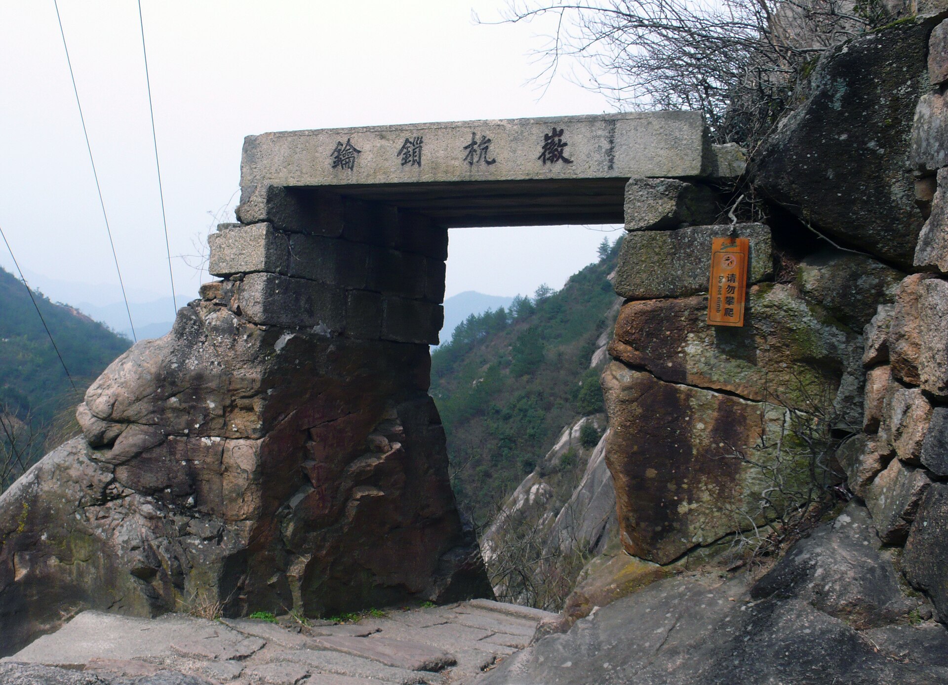
Two things make it the better walk. First, the pass itself: a fortified gate of 1647 with four characters carved above it, standing where the ground falls away in three directions. Second, the village at the eastern end — Xucun, a national heritage site with a cluster of Ming and Qing halls that most visitors to the region never reach because they turn left at Hongcun instead.
The cost is logistics. There is no bus connecting the two trailheads usefully, the route turns through farm yards where the paving briefly disappears, and the villages on the way have almost nothing to sell you. Walk it with a driver arranged at both ends, or walk out and back from Xucun.
The western three: Raozhou, Kaihua, Dahongling.
These are the roads for someone who has already done one of the above and wants to understand what the region looked like before it was walkable as a product.
The Huizhou–Raozhou road is the best of the three and the easiest to justify. Ten to twelve kilometres from Zhangqian in Xiuning over the Wu–Chu boundary stone to Lingjiao in Wuyuan, with a Qing arch bridge at the start, eighteen switchbacks in the middle and a thousand-year camphor tree at Hongguan at the end. The stone on the ridge marks a border drawn in the Spring and Autumn period and a watershed between two river systems — the Yangtze on one side, the Qiantang on the other.
The Huizhou–Kaihua road, about ten kilometres from Lingdi to Baiji, is the quietest. Old tea trees, southern hemlock, terraces cut in strips. It has the least to look at in the way of monuments and the most in the way of landscape, and it demands the most of your navigation.
Dahongling is the shortest and the most legible: 7.5 km, 533 m of climb, paving more than three metres wide, and a ridge where a ruined pavilion still holds twelve Qing stelae and a stone that reads “the highway to the capital.” It was the road to Anqing when Anqing was the provincial capital, and the width tells you it carried more than walkers. If you have half a day in Qimen, this is the one.
How to choose.
If you have one day and no vehicle: Hui–Hang, out and back to the Shicha pavilion. It is the only option that works without a driver.
If you have one day and a vehicle: Zheling from Maoshe to the pass and back, with an hour in Xucun. You get the better stone, the better gate and the better village, and you skip the crowd.
If you have two days: Hui–Hang with a night at Xiaxuetang, then the Zheling on the way west. This pairing is the single most useful comparison the region offers — same century of stone, opposite models of management.
If you have four or five days: the full east-to-west line, adding the Raozhou road and finishing on Dahongling. Our trail overview sets out that route day by day.
If what you actually want is villages rather than roads, none of the above is the answer — take the village loops instead, which stay at lane level and never climb anything.
Lengths, pass altitudes and heritage listings checked 5 November 2026 against county government records and provincial reporting. Entrance prices vary by season and sales channel and are indicative only; confirm at the gate before committing to non-refundable travel.
Walking one of these?
See all five routes and the five-day line →