What remoteness actually buys you.
The Hui–Hang has a gate. The Zheling has signage and a car park. These three have neither, and that single difference changes the experience more than any quality of scenery. On an unmanaged road you notice the paving itself, because there is nothing else competing for attention: the width of the slabs, the drainage cuts, the places where the stone was repaired in a different century with a different size of block.
The trade is straightforward. You get the road without the crowd, and you take on the navigation, the transport and the fact that nobody is coming if something goes wrong. All three of these are short — between 7.5 and 12 kilometres — and all three end in a village, which keeps the risk contained. None of them requires technical skill. All of them require that you have actually looked at a map.
The three roads.
One crosses into Jiangxi, one dead-ends in the hills of southern Xiuning, one climbs a ridge in Qimen. Together they cover the western half of the old prefecture.
Huizhou–Raozhou Trail
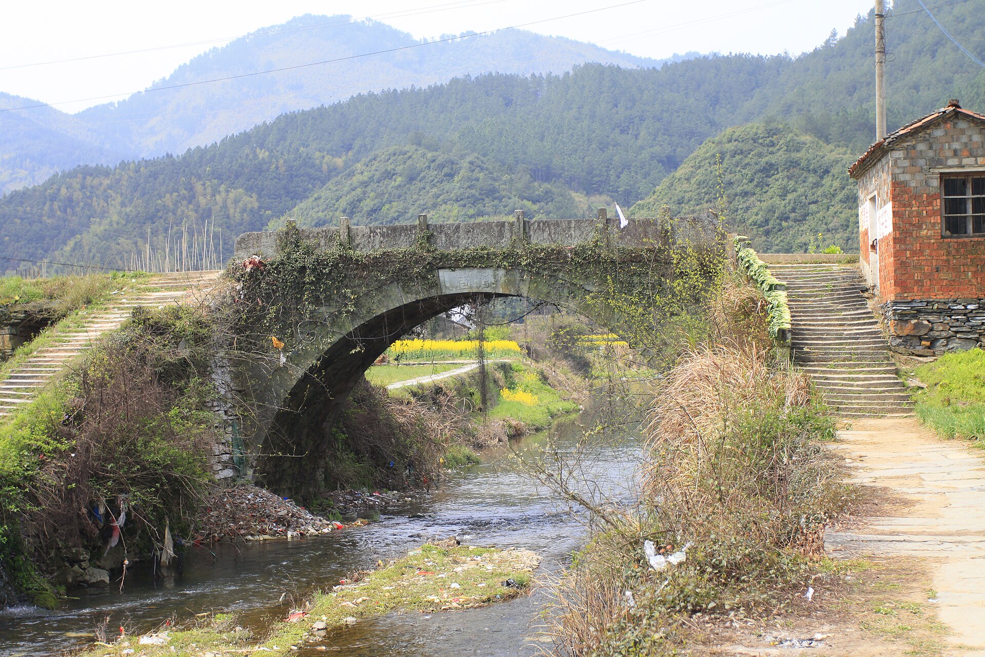
10–12 km · half day · the border crossingThe Zheling section of the merchants’ road to Raozhou, in Jiangxi. It starts at the L’an bridge in Zhangqian, Xiuning — a Qing arch bridge with the words “safe passage” carved on it — and climbs through eighteen switchbacks to the Wu–Chu boundary stone on the ridge. The stone marks a line drawn in the Spring and Autumn period, roughly two and a half thousand years before anyone walked this paving; a Qing inscription of 1710-odd stands there now. The ridge is also the watershed between the Yangtze and the Qiantang, so water falling on either side of the stone ends up in different seas. From the top the road descends to Lingjiao in Wuyuan, with Hongguan and its thousand-year camphor a kilometre further on.
Huizhou–Kaihua Trail
10 km · half day · the dead endLaid out in the late Ming and early Qing as the route from Huizhou toward Kaihua in Zhejiang. It runs from Lingdi in Xiuning’s Yucun township to Baiji, a township in the far south of the county that local descriptions call the last place in southern Anhui to be reached by road — a claim that says more about the terrain than about the road itself. The route passes old tea trees, stands of southern hemlock, and terraces cut into slopes steep enough that the fields are measured in strips rather than areas. Fewer people walk this than either of the others.
Dahongling Trail
7.5 km · three hours · the official highwayIn Qimen county, from Yanwo in Datan township to Yakeng in Anling. This was the road from Huizhou to Anqing, which served as the provincial capital in the Qing — hence the inscription at the top, “the highway to the capital.” The pass is at 773 m and the climb is about 533 m, on paving more than three metres wide, which tells you what kind of traffic it was built for. The ridge is the divide between the Hui and Chi prefectures and the meeting point of four counties. Twelve Qing stelae survive at the ruined pavilion, including a Daoguang-era record of reconstruction. Trenches from an earlier and less peaceful use are still visible along the top.
Know before you go.
Transport is the real difficulty
None of these trailheads is served by a bus that connects usefully with a walking day. The Huizhou–Raozhou road is the easiest — Zhangqian is reachable by road from Xiuning, and there is transport of a sort on the Jiangxi side. Baiji and Yanwo both effectively require a private vehicle and a driver who is willing to wait. Build the day around the car, not the other way round.
Signal is not continuous
Expect gaps on all three, and longer ones on the Kaihua road. Download an offline map before you leave, tell someone where you are going, and carry cash — the villages at the ends may not take a phone, and there is nothing to buy in between.
Free means unmaintained
No fee, no staff, no one clearing a fallen branch. The paving is intact but the edges are not always: there are places where the stone has slumped, where a drainage channel crosses at an angle, and where the path passes through a farm yard and briefly stops being obvious. This is not dangerous terrain. It is terrain that assumes you are paying attention.
Spring, or after the rains
March to May is the best window: the terraces are green, the streams are running, and the light is soft. October and November are drier and clearer but colder on the ridges. July and August bring heavy rain and leeches on the Kaihua road. Winter is possible and quiet, with ice on the north sides.
Three days, west and south.
An outline, not a fixed departure. Access, the state of the paving and local transport arrangements are confirmed for your dates.
- Day one — the border. Drive to Zhangqian in the morning, walk over the Wu–Chu stone to Lingjiao, and continue to Hongguan for the camphor and the village. Overnight in Wuyuan or back in Xiuning.
- Day two — the dead end. Transfer to Lingdi and walk the Kaihua road to Baiji. Ten kilometres, mostly contouring, with the terraces as the reward. Return the way you came or arrange a pick-up at Baiji.
- Day three — the highway. A long transfer west to Yanwo in Qimen, then the shortest and most formal of the three: 7.5 km of wide paving to the pass, twelve stelae at the top, and a descent to Yakeng. Ends within reach of Jingdezhen.
If you only have one day, take the Huizhou–Raozhou road. It has the best combination of a defined start, a memorable high point and a village at the end — and the boundary stone is the single best object on any of these three routes.
Prepare for the actual route.
Shoes with grip, a litre and a half of water, food for the day, a paper map or a downloaded one, and a power bank. A light waterproof shell rather than an umbrella. Long trousers on the Kaihua road in summer. Cash in small notes. Tell your driver the exact trailhead name in Chinese, because the English transliterations are not used locally and several of these villages share names with places elsewhere in the province.
For a quote, tell us which of the three you want and whether you need a vehicle for the day. Ask the proposal to state clearly what happens if the weather turns, since these routes have no shelter and no alternative exit.
Your questions, answered.
Are these safe to walk alone?
The terrain is safe; the isolation is the issue. In remote sections a turned ankle becomes a long day. Walk with someone, carry a means of communication, and leave a plan with your driver.
Do I need a permit?
No. All three are open paths. The only border here is historical — the Wu–Chu stone is a monument, not a checkpoint.
Which is the most scenic?
The Huizhou–Raozhou road for the ridge and the boundary stone. The Kaihua road for terraces and forest. Dahongling for the sense of a road built to a purpose, which is a different kind of scenery.
Can these be combined with the main trails?
Yes, and they work best that way — see the five-day line on the trail overview. Walking a managed road and an unmanaged one in the same week is the clearest way to understand what management does.
References & photography.
Lengths and trailheads follow county government records and provincial reporting. Historical detail draws on county gazetteers and local heritage notices; the “last place reached by road” description of Baiji is a local characterisation rather than an official record.
- Qimen County heritage register: Dahongling, 7.5 km, 773 m pass, provincial listing December 2012.
- Anhui provincial reporting: Huizhou–Kaihua road about 10 km from Lingdi to Baiji; Huizhou–Raozhou road from Zhangqian to the ridge about 4 km, continuing to Lingjiao.
- Zheling ridge: 1,116 m summit, watershed between the Yangtze and Qiantang systems.
- Photo: Zhangzhugang · Stone bridge at Hongguan, Wuyuan · CC BY-SA 4.0. Resized by Wikimedia.